Regions of Alberta - The Grassland

|


|
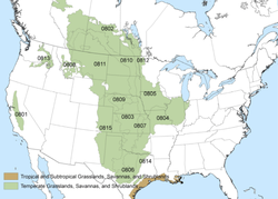
Located in the southeastern corner of the province and comprising approximately 30 million acres of Alberta's total natural landscape is a region referred to as the Grasslands.
Alberta's grasslands are part of the Great Plains that stretch from the Gulf of Mexico, through the United States and into Canada's prairie provinces. 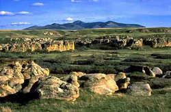
The Grassland Natural Region occupies a broad area of southern Alberta and extends west to the Rocky Mountains and north to the southern edge of the Parkland Natural Region in central Alberta. This region is a flat to gently rolling plain with a few major hill systems. Most of the bedrock is covered with extensive, thick glacial till deposits.
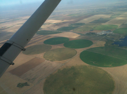
The same long, hot summers that make this region too arid to produce forest give it a growing season ideally suited for field crops. Most years, there is enough spring meltwater and summer rain to meet the needs of wheat, barley and other grain crops. Alfalfa, corn and a host of other more specialized crops also grow where the rivers have been tapped for irrigation farming (See Picture). As a result, more than 80% of Alberta's native grasslands have been plowed and turned into farmland during the past century.
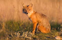
Largely because of habitat loss, more than half the species on Canada's endangered species list are prairie species. These include the burrowing owl, swift fox, ferruginous hawk, and the peregrine falcon. Most other animals found in this region are farm animals, including cattle and horses.

Most of this area's economy is driven by farming, both crop and livestock. As with other regions in Alberta, there is some Oil & Gas exploration in the Grassland region. Recently, wind farms have been installed to capture the energy from wind and turn it into Electricity. Most of these "Farms" are found in the southern part of this region.
Sources: BlackGold School District Alberta Heritage Alberta Parks |
